SDG2-6-7 The food, water and energy nexus
Context: There is a growing recognition of the interdependencies among the supply systems that rely upon food, water and energy. Billions of people lack safe and sufficient access to these systems, coupled with a rapidly growing global demand and increasing resource constraints. Modelling frameworks are considered one of the few means available to understand the complex interrelationships among the sectors, however development of nexus related frameworks has been limited. We explore the use of several models well known in their respective domains (i.e. TerrSysMP, WOFOST and GLOBIOM) where components of each if combined could help decision-makers address the nexus issue. We propose as a first step the development of simple workflows utilizing essential variables and addressing components of the above-mentioned models which can act as building-blocks to be used ultimately in a comprehensive nexus model framework. The outputs of the workflows and the model framework are designed to address the SDGs 2, 6 and 7.
Spatial extent: Ukraine, Europe, World
Dashboard link: https://iiasa-spatial.maps.arcgis.com/apps/webappviewer/index.html?id=66471c4a02e044e889fd9b2e0149e382
Temporal extent: 2020-2050
EVs used: Land cover, Above ground biomass, soil carbon, evaporation from land
Inputs: Land cover, NDVI, Precipitation, Temperature, Soil Moisture, Evapotranspiration
Outputs: Land Cover, Land Productivity, Carbon Stocks , Evaporative drought index, Water Scarcity
Targeted Policy: UN SDG
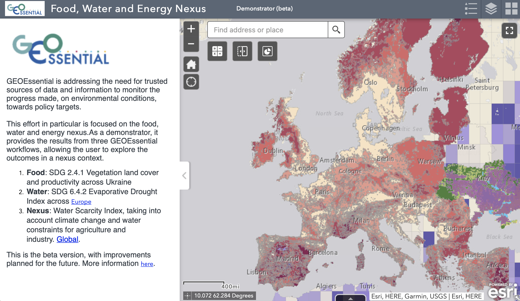
Targeted Indicators: SDG 2.4.1 Vegetation land cover and productivity across Ukraine; SDG 6.4.2 Evaporative Drought Index across Europe; SDG 6.4.1 Improved water use efficiency over time
Main process: This effort in particular is focused on the food, water and energy nexus. As a demonstrator, it provides the results from three GEOEssential workflows, allowing the user to explore the outcomes in a nexus context: Food: SDG 2.4.1 Vegetation land cover and productivity across Ukraine Water: SDG 6.4.2 Evaporative Drought Index across Europe Nexus: Water Scarcity Index, taking into account climate change and water constraints for agriculture and industry (i.e. energy requirement) Global.
Level of development: 75%
GitHub code: N/A
Outputs endpoints: https://geoessential.unepgrid.ch/geoserver/
Link to the VLab: https://vlab.geodab.org
Partner(s): IIASA, SRI, FZJ
Contact Person: Ian McCallum (IIASA) – mccallum@iiasa.ac.at